

Cambridgeshire LSOA Local Names | Cambridgeshire Insight Open Data
Cambridgeshire and Peterborough Insight | Open Data Portal
Organisations are sharing data in order to change the way we all live and work across Cambridgeshire and Peterborough as well as meet requirements for Open Government.
This site is managed by Cambridgeshire County Council but publishing partners also include Peterborough City Council.
Have a look at our partner site Cambridgeshire and Peterborough Insight to discover research intelligence including interactive maps and reports across a range of themes including crime, economy, deprivation and population.

Available Topics
Select a topic to view datasets in that category
Latest Data Stories
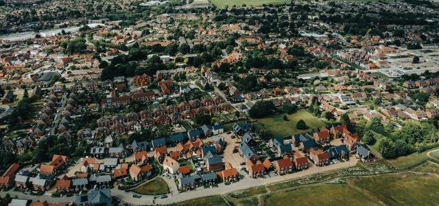
In this data story, we highlight some of key findings from Cambridgeshire’s 2020/21 housing completions data.

The locations for the car parks can be visualised in the map below.
Publishers

Cambridge & District Citizens Advice Bureau (CCAB) provides free advice which ensures that people find a way forward from their problem. Help is offered in relation to a wide range of...
A collection of datasets released by the Greater Cambridge Partnership.
A collection of data sets and information to support grant applicants to prepare project proposals that can make a positive impact on people’s lives and reduce their need for council services.
Datasets
Our annual Workforce Diversity Profile has been published for 2024. The report highlights our workforce as of June 2024 and provides valuable insight into the diversity of our organisation.This...
Data is currently available for the period 1st January 2017 to 30th April 2026.2025 and 2026 data is provisional at the time of preparing the data and is likely to be incomplete for the most recent...
LSOAs or Lower Super Output areas are statistical geographies that cover the entirety of England and Wales, in all there are around 33000 LSOAs. They were designed for the Census 2001 as a way to...