
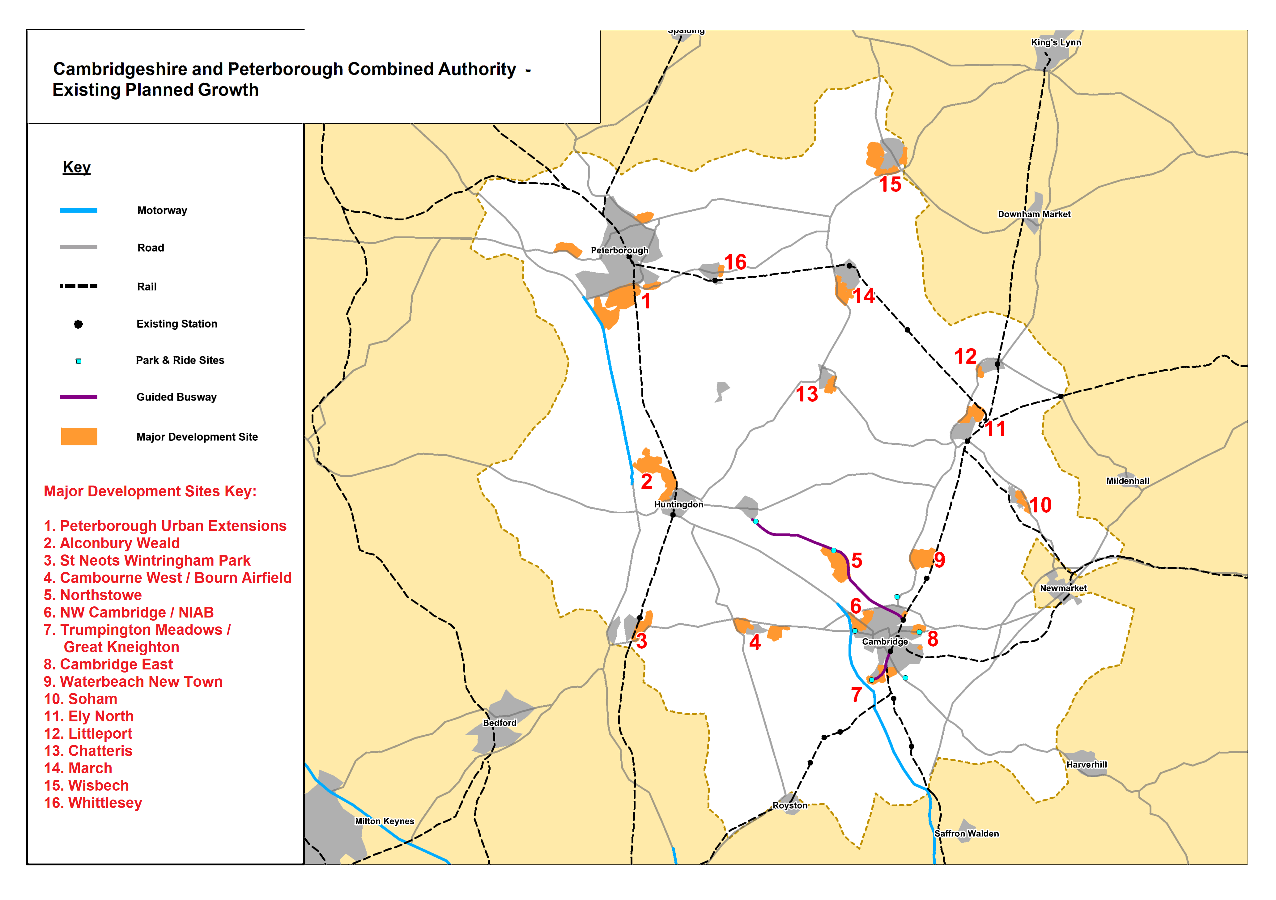
Map of Combined Authority development areas with transport links
Revisions allow you to track differences between multiple versions of your content, and revert back to older versions.
Combined Authority Development Areas
Resources
- Basic Combined Authority districts
- Basic Combined Authority (no text)
- Basic Combined Authority market towns and roads
- Combined Authority districts with road map
- Combined Authority Development Areas
- Combined Authority Map with Transport Links
- Cambridgeshire Districts - Market Towns and Key Roads
- Cambridgeshire Districts with Key Transport Links
- Basic Cambridge Map
- Basic East Cambridgeshire Map
- Basic Fenland Map
- Basic Huntingdonshire Map
- Basic South Cambridgeshire Map
- County Growth Corridor
- Regional Growth Corridor
- Combined Authority Housing Market Area
- LEP (Local Enterprise Partnership) with Settlements / Roads
- Cambridgeshire Parishes
- Cambridgeshire and Peterborough Parish Map
- Cambridgeshire and Peterborough Parish Boundaries Map (2024)
- Cambridgeshire and Peterborough Boundary Map
- Cambridgeshire and Peterborough District Boundary Map
- Cambridgeshire Boundary Map
- Cambridgeshire and Peterborough Overview Ward Boundaries Map
- Cambridge Ward Boundaries Map
- East Cambridgeshire Ward Boundaries Map
- Fenland Ward Boundaries Map
- Huntingdonshire Ward Boundaries Map
- South Cambridgeshire Ward Boundaries Map
Additional Information
| Field | Value |
|---|---|
| mimetype | image/png |
| filesize | 687.26 KB |
| resource type | file upload |
| timestamp | Mar 27, 2019 |